Monday, March 26, 2007

Awesome Dude!!


Be Brave, even if you're not, pretend to be...trust me no one can tell the difference.

The first Sky Dive is a scary thing and you can expect sensory overload as your mind/body/soul fights against every natural preservatory urge.

As you step into thousands of feet of emptiness and freefall at speeds of 200kph you realise that nothing could have prepared you for this incredible sensation.

Why jump out of a perfectly good aeroplane?
Well equally...Why climb a mountain or run a marathon?
Deep in the human consciousness is a pervasive need for a logical universe that makes sense; but the real universe is beyond logic. We do these things because there is something deep within us that drives our need to feed our voracious appetite for danger and glory...thats the spirit of man.

We all think What IF?

I must not fear, fear is the mind killer.
Fear is the little death that brings total obliteration.
I will face my fear.
I will permit it to pass over and through me.
And when it has gone past I will turn the inner eye to see its path.
Where the fear has gone there will be nothing.
Only I will remain.
Frank Herbert

Sunday, March 25, 2007

Monday 26th March 2007. Wanaka. New Zealand.

Up and out for breakfast at Relishes Cafe where the menu is overly fancy and the food overly average...However, there is little choice as today is a public holiday and I have come to expect things to be a little pretentious in this town.

Well today its all systems go for me to Skydive Lake Wanaka.

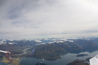
As adrenalin fuels my mind I am told that this is the most spectacular Skydive in New Zealand and that the scenery will fill my soul.

How true.

Our scenic flight was well worth the almost $600 I have paid and as we get to 15,000ft I begin preparing to be first out with my instructor Grant McDonald...a good Scots man!

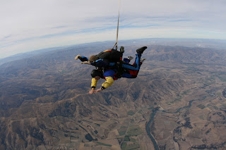
What a rush as we freefall at 200kph or 180ft per second...take your pick. I love it, and the views across New Zealand's highest snow capped mountains were spectacular including both Mt Cook (some 150km straight ahead of us)and Mt Aspiring.

Here I am freefalling for a full minute amongst the majestic peaks that tower over Mt Aspiring National Park, over glaciers, glistening lakes and rivers.

They say that only mad dogs and Englishmen go out in the midday sun...well Only mad dogs and Scots men jump out of perfectly good planes in the middle of a beautiful day.

It was exhilarating, I felt like a bird as we glided down and Grant was kind enough to ensure that although we were first out we were last to land...allowing me even more time to enjoy the views spread before me.

Sunday 25th March 2007. Te Anau to Wanaka. New Zealand.

Today we head to Wanaka via Frankton where we had lunch at Famous Kelly's. We then head up and over the stunning Crown Ranges, the highest road in New Zealand, to our destination where we checked into the Fairway Motel.

Wanaka is a very pretty little town, extremely twee and touristy and thus over-priced.

Saturday 24th March 2007. Milford Sound. New Zealand.

If the major attraction of Southland is the Fiordland National Park then Milford Sound is its glorious heart.

Milford Sound is commonly referred to as New Zealand's most beautiful spot...and that is saying something in this fabulous country.

Enroute this morning we stop at the Mirror Lakes. These lakes were created by the Eglinton River as it flowed through the valley. At some point in time the river shifted position and abandoned these deep pools. Deposition partially filled the channels leaving isolated pools called Oxbow Lakes. The lakes are fed by the snow and rain-fed Black Creek.

The Eglinton River starts at The Divide and flows down the valley to Lake Te Anau.

Today we cross that Divide to the West Coast.

West Coast folk are known as Coasters and are regarded as a rare breed of independent, feisty, down to earth and hospitable folk. This may be a reflection of the isolation of the West Coast which sits between the towering Southern Alps and the Tasman Sea.

The Maori were the first to discover the West Coast as they sought out the sacred greenstone or pounamu; in the 1860's gold fever was to draw many Europeans.

Within its borders the West Coast is home to five of New Zealand's fourteen National Parks: Kahurangi, Paparoa, Arthur's Pass, Westland and Mt Aspiring. A landscape of rushing rivers, wild coastline, ancient rainforests, mountains, lakes and glaciers; the area is infact home to more than 60 glaciers in the Westland/Tai Poutini National Park including Franz Josef where I am heading in a few days.

Today I am Kayaking on Milford Sound and it is a spectacularly beautiful spot on this splendid day. My partner in crime is Joanne and we set quite the pace.

Out on the Sound for over four hours (a Sound is a flooded river valley and Milford Sound was actually wrongly named as it is a fjord and thus cut by glacial activity); we see many fur seals. We are also lucky enough to see a White Heron and some Cormorants up close.

Milford Sound was where according to Maori legend the fiords were created not by rivers of ice, but by Tu Te Raki Whanoa, a godly figure who came wielding a magical adze and uttering incantations. Piopiotahi (Milford Sound) is without a doubt this God's finest sculpture and they say that whatever the fiord's mood, be it teeming with rain, or glistening with the sun on the deep waters, you will be inspired...and I have to agree.

Our afters are at the Blue Dock Cafe before we head out back to Te Anau.

On the way back we visited The Chasm which is a true wonder of nature. Carved by the power of water, where hard and soft rock meet, this area is a reflection of the fact that water continues to shape our geological history.

As waterfalls cascade down steep rockfaces and mists cover the mountain tops the feeling of Gandalf is confirmed by the Kea birds circling above us as we pull to the side of the road. They seem totally unconcerned by human interaction.

Dinner tonight is with the group at Redcliff, a rather pretentious little place with average food.

Thursday, March 22, 2007

Friday 23rd March 2007. Queenstown to Te Anau. New Zealand.

Research and artefacts, adzes and chisels dating back around 400 years suggest that the Maori stayed in Te Anau for relatively short periods of time. They were either travelling between the southern coastal plains and Milford Sound on greenstone collecting expeditions or on summer food gathering trips (eeling and bird hunting).

Maori from the south coast are thought to have settled during the summer months on the banks of the Upukerora River just north of Te Anau to gather food.

Evidence has also been found of Maori occupation around Lake Orbell (known to the Maori as Te Wai O Pani - the Lake of the Friendless). Lake Orbell is located above the Te Anau Glowworm Caves and it is thought that a small group of Maori escaping hostilities may have retreated to this area.

The first Europeans to see Lake Te Anau were the explorers C.J.Nairn and W.H.Stephens in the 1850's. Led by two Maori guides their journey began on the south coast. Heading inland, they eventually followed the Waiau Valley. Nairn's sketch of Lake Te Anau was the first known pencil sketch of the lake.

Withing two years the first runholders arrived and pioneered farms, establishing the Te Anau Downs Station in 1860. The lake provided valuable access for supplies and freight before any tracks or roads were established.

The first residents settled near today's township in the early 1880's with the first hotel built in 1891.

The Southland Acclimatisation Society established a base at Te Anau in 1921 and built a hatchery that in 1923 produced fish stocks for the southern lakes.

By 1927 a metalled road to Te Anau was completed and some bridges built. The first holiday cottages were built in 1932, however Te Anau remained without electricity or shops until after 1945.

The completion of the Milford Road in 1953 saw tourism to the area significantly increase and today the town is a hub for sightseeing activities in the Fiordland National Park.


Today we head to Te Anau on the shores of New Zealand's second largest lake.

Lake Te Anau has three arms called South, Middle and North Fiords and it is 352sq kms in area and some 61 km long. At its deepest point it is 417m deep with an average temperature of 8 degrees celsius. Lake Te Anua feeds into the Waiau River that flows into Lake Manapouri the site of the Manapouri Underground Power Station and it also serves as a storage reservoir (controlled within its natural flow levels) for power generation.

After checking into the Edgewater we are off to Te Anau Glowworm Caves on the isolated western shores of Lake Te Anau.

That is after a quick stop at Miles Better Pies for lunch.

The caves are the lower section of the extensive Aurora Caves system that lie within the Fiordland National Park, part of the Te Wahipounamu world heritage area.

Our journey begins with a 35 minute cruise across Lake Te Anau before we enter Cavern House for a presentation on the caves.

For many years the caves were lost in legend. Known to the Maori as Te Ana-au meaning 'caves with a current of swirling water' it was this very water that led to their rediscovery in 1948.

After many years of searching explorer Lawson Burrows discovered a stream emerging from under a rock buttress. Pushing himself underwater through the entrance he surfaced into a cavern of glowworms.

Today we will discover a world of sculpted rock and rushing waters before the climax of our trip...a silent drifting by boat beneath the luminous shimmer of thousands of glowworms. We will move underground by path and small boat.

These caves are relatively young in geological terms at around 12,000 years old and water action is steadily eroding the fractured limestone. Remember that when combined with Carbon Dioxide, water forms a weak acid that dissolves limestone rock
and so these caves are still being formed by the actions of the water.

At times, like today, the Tunnel Burn flows through the cave system with spectacular force. From the rock formations and fossils to the waterfalls and whirlpools this is a spectacular sight...but the highlight has to be the glowworms.

When they ask for a volunteer to eat like a glowworm, I naturally oblige; but trust me, the stone fly won't catch on as a delicacy in my house!

Into the glowworm grotto and the reason for being here.

New Zealand glowworms (titiwae) are a native to the country and quite distinct from glowworms elsewhere in the world. Their Latin name Arachnocampa Luminosa divides to Arachno meaning spider-like (these glowworms spin silk lines to catch flying insects); Campa meaning larva and Luminosa meaning light-producing.

Glowworms are members of the insect family, fungus gnat fly. They live by catching flying insects attracted by their light. The glowworms life cycle has four stages: egg, larva, pupa and fly with an entire life-cycle lasting 10-11 months.

While life cycle stages are present all year round there is an increase in hatching around December and the thinking is that this is related to the increased food available after the long winter (remember the seasons are the opposite way around in the Southern Hemisphere).

The glowworms in these caves feed on insects hatched from the waters of the Tunnel Burn. Their main predator is the harvestman which looks like a spider but is infact a separate though related species. The harvestman does not spin a web but actively moves around to hunt prey.

When food is scarce and if glowworms are living too closely together they are known to cannibalise each other. The environment has a major effect on glowworm populations, e.g. during flooding glowworms living close to the water are washed away. The humidity of the air is also a vital factor as glowworm survival is dependent on a level of humidity that is near saturation point; if the air is not moist enough the glowworms dry out and die.

Cave environments are simpler than the sunlit world with few changes in temperature or humidity throughout the year. These caves are home to all sorts of small and harmless insect life such as the cave weta, earthworms, isopods, amphipods, millipedes, spiders and some ground beetles.


Larvae build a hollow, tubular nest which is attached to the cave ceiling by fine threads. From this nest they suspend up to 70 strings, between 20mm and 150mm of thick sticky droplets of mucus known as the fishing lines. The larvae lie on their backs to enable vibration-sensing organs to quickly sense movement in the fishing lines. The larva glows brightly and insects attracted by the light fly into the sticky threads and are caught. The glowworm then moves quickly to the lines and hauls them up to its nest. It bites into the food with sharp powerful jaws discarding only the wings and other parts of the insect's carcass it cannot digest.
When bringing in a line the larva hooks the spare line on to bristles on its back. The larva continually grooms its fishing lines and slowly increases their length.

The light of the glowworm larvae is given off by small tubes finishing around the glowworm's tail end as a by-product of excretion. This process is caused through the chemical oxidation of a substance called luciferin by the enzyme luciferase. Part of the energy is liberated as a cold light due to no heat being associated with it. The light has been estimated to be equivalent to one thousandth of a millionth of a watt (one nanowatt) in intensity. The blue-green light shines from inside a layer of respiratory tissue that acts as a reflector. The hungrier the glowworm, the more brightly it glows.

There are two interesting types of cave dweller:

Troglophiles (or cave lovers) can survive their entire lifetime in caves, but they can also live exclusively on the surface where they select cool dark places reminiscent of the cave environment. The glowworm is a good example as they are equally at home in the cave or a suitable bush environment.

Troglobites are highly adapted to cave life and cannot survive outside caves. With no need for camouflage or protection from the sun, many have lost pigmentation and are white. Most have developed highly sensitive sensory organs to detect predators and prey, harvestmen are among this group.

Today I got again to see the long finned eel here inside the caves in the Tunnel Burn. Such Eels can grow up to 1.7 metres.

And to access all this we walk through rainforest...this is a natural history treat!!

In the late afternoon we had a group cocktail party on the patio before heading out to see Ata Whenua (Shadowland).

Ata Whenua was created by two men. Kim Hollows, a helicopter pilot in Fiordland for 25 years was the man behind the concept and also the films producer. Dave Comer (who was the cinematographer for The Lord of the Rings trilogy) was the director.

Kim decided to put the film together to show the beauty's of Fiordland that most people don't get to experience. From concept to completion the film took ten years to put together beginning in the mid-1990's with the film premiering in October 2004.

The three birds that feature prominently in the film are the Kea, the Kakapo and the Takahe. Both the Takahe and the Kakapo are endangered species with only 250 and 86 respectively left in the country. To help preserve these species a percentage of the films ticket sales go towards the endangered species program.

Why these birds are endangered has a lot to do with the introduction of deer in 1905 to New Zealand as the deer impacted on the birds food source in a major way.

The Fiordland Cinema in Te Anau was built by Kim and it is used exclusively to showcase the film. It is the only place in the world where you can experience Ata Whenua in 35mm on a big screen.

Back at the hotel and I dine with Patty, Joanne and Liz.

In putting together today's blog I acknowledge the information of Real Journey's and Fiordland Cinema.

Thursday 22nd March 2007. Queenstown. New Zealand.

Project work all morning so I am entitled to my jetboating afternoon.

The Jetboat is a New Zealand invention developed by Bill Hamilton, a South Island high country farmer who had been prevented from accessing areas of his farm due to shallow rivers. Initially designed to accommodate the narrow, shallow and braided Kawarau and Shotover rivers its maneuverability and ability to travel in less than 3cm of water makes this an engineering phenomena.

Kawarau Jet was the world's first commercial jetboat company and it has been established for over 40 years. My 43km ride takes me from Queenstown Bay to cruise Lake Wakatipu towards The Remarkables; one of only two mountain ranges in the world that run North South. Down the rapids and we go under the Kawarau Falls Dam to continue our 360's on the Kawarau River. Yesterday I bungyed into this river and today I am jetting on it.

We then head into the shallow braids of the Shotover where you can really feel the lack of water as you ride over the pebbles. The Shotover River in 1862 became the second richest gold-bearing river in the world and it is amazing to be going some 85kph in just a few centimetres of water. The adrenaline rush is acute as we head straight for obstacles making our turn only at the last possible moment.

The best seat in the house is mine. In the row behind the driver and in the middle. I get the thrill of driving yet I remain the only one on the boat not to get wet.

The world's first jetboating company, Kawarau Jet was born in the summer of 1960 and the decade certainly was destined to swing in these boats. Inextricably linked to the Lakeland Christian Camp when camp trustees and Invercargill brothers Harold and Alan Melhop made the first powered navigation of the Kawarau Falls Dam in a Hamilton Jet 30.

Holidaymakers were soon lining up for rides on this thrilling new boat and at five shillings a go the trip was a very efficient fundraiser for the Christian camp...so began a Queenstown tourism institution.

Kawarau Jet has become known for the introduction of many safety features such as the establishment of the roll bar system that is now an industry standard in 1989; the innovation of twin engine technology in 1995 or the 2000 introduction of heated, shock absorbing suspension handrails.

So how does it work?

Put simply water is sucked through a grill flush with the hull by an internal propeller. This delivers the jet thrust above the water level through a round nozzle which gives the steering by diverting the jet of water.

After the boating, Alex and I head into Underwater World where I get to see a New Zealand Longfinned Eel close up. These Eel's are only found in New Zealand and they can live up to 90 years growing to weights of up to 25kg; although the males are smaller than the females. They will spend most of their life in fresh water and they only journey out to the ocean once, to spawn and die.

Before I head back to project work there is time for a quick coffee at Patagonia Chocolates.

The English teacher in me would be remiss if I did not mention the beauty of this Lord of the Rings landscape where I currently find myself. Queenstown is the capital of Middle-Earth and the gateway to Tolkienesque scenery that is beyond compare. The area around here is arguably the biggest natural movie set in the history of celluloid. The Kawarau River for example was River Anduin; The Remarkables, the slopes of Dimrill Dale and so on...

Here in the Southern Alps the thought of hordes of orcs, wizards and goblins going about their daily business is not so far suspended from reality. And you can see why New Zealand is rapidly becoming a popular film set. Other classics such as The Lion, The Witch and The Wardrobe have been filmed here in the South Island.

Tonight I dine with the Glasgow boys, Shaz and Harri, at a Queenstown institution Fergburger.

Tuesday, March 20, 2007

For the Students of St Ronan's Primary and New Lodge Schools in the UK.

The story of the Lady of the Lake...

Lake Wakatipu is the home of the Lady of the Lake. The Lady is actually a vintage steamship called the TSS Earnslaw and it holds a special place in the hearts of Queenstown people.

One of the last remaining coal fired passenger vessels in the southern hemisphere the ship was built in 1912 and was a vital link for the people of the remote farming communities living around the lake. As a cargo ship she was capable of carrying 1,500 sheep and 30 cattle on her decks. The Lady was both the largest and the grandest ship ever to grace the lake.

However, when road access improved in the 1960's the old Lady was no longer required and the demand for her services declined dramatically. After some unsuccessful private charters she came into service in 1969 as a tourist vessel and was completely refitted to restore her to her original glory.

Today this almost 100 year-old Lady puts in 14 hour days on the lake and works for a full 11 months every year.

For the Students of the Twenty-First Century Learning Center. Little Valley. New York.

The Legend of Lake Wakatipu...

New Zealand's third largest lake is some 82 km long and in parts up to 380 metres deep. ..But what makes this lake unique is that it breathes.

The water level in the lake rises and falls as much as 12 centimetres every five minutes. Geologists will tell you that this is because of wind or variations in atmospheric pressure. The scientific story is that during the last ice age i.e. around 15,000 years ago, glaciers covered most of this region and a glacier coming down from the North West carved out the lakebed.

For the Maori the truth is rather different...

Lake Wakatipu was born as a result of the death of the giant Matau. Matau was responsible for carrying off a woman by the name of Manata who was the daughgter of a Rangatira (Maori Chief). Her brokenhearted father promised marriage to any man who was able to rescue her from the giant.

A brave young warrior by the name of Matakauri determined to do just that. He waited for the warm northwest wind and knowing that Matau would be asleep at this time he set out.

Towards the eve of the day he found Manata and she told him through her tears that the giant had tied her to him with a long cord that could never be cut. This cord was plaited from the hide of one of the giants two fierce dogs.

Matakauri was not scared by this and he went to the river to build a raft to carry her away. When he was ready he found that he was still unable to cut the cord. Manata began to cry all the more. Her tears fell on the cord and at once it parted. Matakauri's raft then took them off to safety and they were soon married.

The next time there was a northwest wind Matakauri returned to kill Matau. He climbed the hill where the giant lay asleep and piled bracken around him before setting him on fire.

The monster was burnt to death but the fire also burnt a deep hole in the ground in the shape of his body. The rivers filled this hole with water that formed the lake. Legend has it that the giant's heart still beats under the waters and so the lake continues to rise and fall.

Wednesday 21st March 2007. Queenstown. New Zealand.


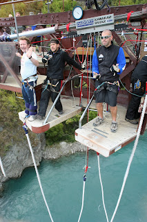
Trust me...the anticipation is definitely the worst bit as you cling white-knuckled to the take-off platform...


Queenstown was so-named because it was considered to be "fit for Queen Victoria". Here on the shores of Lake Wakatipu the town is surrounded by the Remarkables mountain range amidst the alpine scenery of mountains, lakes and rivers in the snow rich Southern Alps.

Geologically speaking this is a young and continually evolving landscape. The Remarkable's are the result of the faulting and folding of schist rock in such dramatic forms that many rock faces are near vertical. The continental glaciers that once covered this entire Lakes District were blankets of ice sometimes 2,000 metres thick.

In terms of Lake Wakatipu the moving ice picked up masses of rock from the mountain sides and valley floors and both grinded the hills smooth and gouged out the deep troughs that we know today as the Southern Lakes.

Queenstown was established in the 1860's as a goldmining camp and today it is known as the World's Adventure Capital.

The first humans in this region were the Polynesian Moa hunters who are known to have been here around the thirteenth century. The Maori were next coming here in search of food, fibre and stone. They also hunted the large flightless Moa and they are credited with discovering the sources of Pounamu (or greenstone) at the head of the lake. Greenstone was not just ornamental, but served a useful role both in the manufacture of tools and for weapons.

The first European exploration was in the 1860's by a young Southland farmer, Nathaniel Chalmers who was guided by two elderly Maori. With Reko, the Chief of the Tuturau and Kaikoura he had set out from Mataura in September of 1853 with a plan to explore the northern inland territory routes known to the local Maori. He first saw Lake Wakatipu from the Sleat Range near Garston.

The Crown Range route running between Wanaka and Queenstown through the Cardrona Valley was to become one of the principal tracks for the goldminers and early sheepmen. This route, which rises to 1,120 metres, remains the highest main road in New Zealand.

Although others had reached the lake before them, William Gilbert Rees and Nicholas Paul Baltasar von Tunzlemann made in 1860 the first successful approach to the lake basin from the east.

Rees is regarded as the pioneer of Queenstown as he established his homestead on the present site of the town facing towards Queenstown Bay.

The story of the two men goes thus...

they married sisters and after the toss of a coin, Rees and his wife choose to reside on the Queenstown side of the lake and had two very successful and peaceful years before the goldrush took over and the miners poured in. The area was then declared a goldfield and Rees was paid ₤10,000 to vacate his property.

The Von Tunzlemann's across the lake suffered badly from stock deaths and snow storms and they were finally forced from their land by a lack of money.

It could not be the mid-1800's without a Goldrush...

Large quantities of alluvial gold were discovered in the Arrow River in late 1862 by William Fox, John O'Callaghan and others and this started a rush of miners even coming from the Australian and Californian fields. The shanty towns that sprang up to accommodate tents, stores and bars eventually became Queenstown and Arrowtown.

But how did Queenstown become the Adventure Capital of the World?

The origins lie in Bungy Jumping when in 1988 AJ Hackett opened the world's first commercial bungy site on the Kawarau Bridge.

Built in the 1880's to connect Queenstown and the rest of Central Otago (in the days of the goldrush) the bridge was replaced in the 1960's and fell into a state of disrepair. Transformed by Hackett and Henry Van Asch this site was soon to be copied by extreme sports enthusiasts the world over.


As they say...it takes a certain kind of person to step out of an aircraft at 15,000ft into thin air. Plummeting towards the earth for 60 seconds at some 200kph this is terminal velocity.

They claim that the only thing preventing you from enjoying one of the most primal life shaping experiences is your own mind...today it was the weather. I was there for my 8.30am jump but Mother Nature had decided otherwise.

So after breakfast at the Naff Caff on Shotover Street and a morning of work on the project I am off to follow the history trail and Bungy from the Kawarau Bridge...let's hope I return??

Bungy has its origins in Vanuatu in the Pacific where people have been throwing themselves from huge towers for centuries with nothing more than a few vines attached to their feet. In the 1970's these ancient rituals inspired members of the Dangerous Sports Club at of one of my alma maters (Oxford University) to begin a few experimental jumps...famously from the Clifton Suspension Bridge and into the arms of the law in 1979.

However the story really takes off in the 1980's with AJ Hackett teaming up with fellow speed skier Henry van Asch to develop bungy as a modern sport. After extensive stress testing conducted on latex rubber cords a series of extreme jumps were made. The first at Ponts de la Caille was a 147m jump near Annecy. The famous jump though came in 1987 when AJ jumped from the Eiffel Tower and the bungy legend was born.

On November 12th 1988 the Kawarau Bungy Bridge became the world's first full time bungy site and the offical home of the Bungy...and today I made my successful leap!

The world's first bungy site sits here some 43m above the crystal clear waters of the Kawarau River. The cords used to bungy are made from natural latex rubber and they are manufactured from latex strands. They are produced in 5 different density's from super-light (18 ply) to super-heavy (36 ply) and are selected according to the weight of the jumper. Cords are used for an average of 500 jumps and they are never more than 6 years old.

Between opening and November 2003 an estimated 5500m (5.5km) of bungy cord has been used at Kawarau Bridge. AJ Hackett manfacture approximately 785m of bungy cord each year.

Back in town and we have cocktails with our group at the motel before Jill, Alex and I head out for dinner at @ Thai.

Tuesday 20th March 2007. Mt. Cook to Queenstown. New Zealand.

Today I head to Queenstown via Twizel. If New Zealand is the home of extreme sports then I am assured that Queenstown is the Capital City.

We stop for lunch at the Oasis Cafe in Oamaru before continuing our journey to the town thought 'fit for Queen Victoria'.

After checking into the Lakeside Motel Alex and I head off to explore the town stopping for ice-creams at Patagonia Chocolates.

As a group we take the gondola ride to Bob's Peak where the views over the surrounding countryside are breathtaking. From here you can see the wonder that is Lake Wakatipu in all its glory. 84km long and 5km wide the lake drops to 399m in parts and has an average temperature of 11.5 degrees celsius.

The Doppelmayr gondola ride that we have just enjoyed opened in September 1987 and takes you on 35mm cable to a top station that sits some 790m above sea level. You travel along 1540m of rope at some 3.5m per second enroute to the summit.

Jill, Alex and I also enjoy a drink (a Cosmopolitan in my case) in the bar before heading down to Winnie's for dinner. Winnie's is a must, if not for the food, at least for the roof that opens fully to the elements.

Patty, Joanne, Jill, Sarah, Liz, Alex and I round the night off with a visit to Minus 5 the coolest bar in the southern hemisphere. Eighteen tonnes of ice have gone into constructing Minus 5 with the walls, the bar, the sculptures, the seats and even the glasses we drink from made of ice. Whilst we all put on jackets, gloves and booties for the 30 minute experience; I am the only one in there in shorts...now how did that happen??

Monday 19th March 2007. Mount Cook. New Zealand.

Up early and after a hearty breakfast Alex and I set out to hike the Hooker Valley. Our first point of interest is the site of the original Hermitage Hotel which was the first accommodation house in the National Park.

A construction of cob and adobe the Hermitage was built by Mt Cook's first ranger M. C. (Frank) Huddleston at White Horse Hill in 1884. The building was soon to be clad with corrugated iron as it could not withstand the harsh alpine weather.

In 1885 a group of South Canterbury runholders and businessmen formed the Mt Cook-Hermitage Company and they took over Huddleston's Hermitage. However this company was destined to get into financial difficulty and after expanding too much the government stepped in and took over.

Circa 1911 with tourism on the increase and accommodation in demand the new owners decided to upgrade and built an extension on the site. But in January 1913 after 16 days of rain, the Mueller River broke its banks at Kea Point and water flowed through the Hermitage of White Horse Hill. The following month the Mueller flooded again. This time carrying the annex to the Hermitage with it and depositing the building downstream. The Hermitage was now damaged beyond repair and as a result a second Hermitage opened in 1914 on the site of the current and third Hermitage.

Miss Freda Du Faur the Australian climber who was the first woman to ascend Mt Cook was in The Hermitage at the time of the great flood with chief guide Peter Graham.

The Hooker Valley is home to some of the highest mountains in the Southern Alps which formed around two million years ago and our next stop is the Alpine Memorial to all those lost to the slopes. Refurbished in 1994 the memorial was rededicated to commemorate 100 years of New Zealand Alpinism.

Although less than 50km from the Tasman Sea the only direct route to the open waters consists of a three day climb over the 7,000ft Copland Pass.

We continue on to the Mueller Lake Lookout and the Stocking Stream enroute for Hooker Lake.

The glaciers here are fed with snow created by the high mountains and the moist westerly air steam. I find the glacier at Hooker Lake much less impressive than when I recently visited Perito Moreno Glacier in Argentina.

Whilst Moreno melts vertically and displays a beautiful ice field, the Hooker Glacier melts horizontally and as such it is covered by sediment giving it a dirty appearance and making the lake waters grey.

The majesty of Mt Cook unfolds as we hike on a beautiful sunny day and my thoughts turn to that first ascent on Christmas Day 1894 when Jack Clarke, Tom Fyfe and George Graham reached the summit.

Tonight Alex and I dine at The Glencoe.

News Update... A lahar (a burst in the crater wall) meant that yesterday, Sunday, the crater lake at Mt Ruapehu began to tumble down the mountainside. Unlike the Tangiwai Disaster of 1953 there were no injuries this time in the National Park area where I was just a few weeks ago.

Sunday 18th March 2007. Christchurch to Mount Cook. New Zealand.

Mount Cook is Australasia's highest mountain and it is located in the Southern Alps which are New Zealand's largest mountain range.

This morning our bus journey takes us through South Canterbury to Geraldine where I enjoy fresh cheese from Talbot Forest Cheese Store. These small dairy factories were once common place across New Zealand, but today the independents are few and far between as the multi-nationals now dominate this once staple rural industry.

Our next stop is Lake Tekapo from where we pass the Tasman Glacier enroute to Mt Cook Village. Sir Edmund Hillary used Mt Cook as a preparation base as he worked towards his assault on Mt Everest.

So here I am on the eastern side of the Southern Alps and this is where I become aware of the striking difference between the geology of the North Island (essentially volcanic) and the South Island (essentially created by the actions of tectonic plates).

Outside the Hermitage Hotel, where Alex and I have lunch, stands a statue to Sir Edmund who along with Sherpa Tenzing Norgay made the first successful ascent of Mt Everest on May 29th 1953. The statue was commissioned by The Hermitage to mark both the 50th anniversary of that ascent and the influence Aoraki (Mt Cook) National Park had on Hillary's early climbing experience. The statue also recognises his work in providing schools and medical facilities for the Sherpa people of Nepal and his contribution to the protection of the culture and beauty of the Himalaya.

We are staying here at the Aoraki/Mt Cook Alpine Resort and after lunch Jill, Alex and I head off to hike Governor's Bush.

Dinner tonight was at The Old Mountaineers before a game of Trivial Pursuit in the lodge lounge.

Friday, March 16, 2007

For the students of the Little Valley 21st Century Learning Center.

The Legend of Paikea...

Paikea came to New Zealand from the Pacific Islands on the back of a whale many many centuries ago. Today the Kati Kuri people of Kaikoura (an area world famous for whale watching) are among his descendants.

Paikea was the youngset and the favoured son of Chief Uenuku and he came from Mangaia in the Cook Islands. His fathers favouritism made his older brothers very jealous and so they joined together in a conspiracy to kill Paikea. They would kill him while they were fishing offshore and tell their father that he had drowned.

The night before the deed was to be done, Paikea pretended to be asleep and listened whilst his brothers plotted to kill him.

When they were far out at sea he foiled their plan by deliberately sinking the canoe and drowning his brothers.

Adrift in the ocean he clung to a plank of wood waiting for his own death.

However Tohora the whale had other ideas and he lifted Paikea on to his back and took him south to New Zealand and the settlement of Whangara north of Gisborne where he began a new and prosperous life.

Many years later one of his son's Tahupotiki travelled further south and became the founder of the South Island tribe the Ngai Tahu. It is from both Tahupotiki and Paikea that the Ngai Tahu and Kati Kuri of Kaikoura claim their descent.

Legends for TODAY...

Whale Watch is a multi award winning nature tourism company that is both owned and operated by the Kati Kuri people of Kaikoura (a Maori sub-tribe of the South Island's larger Ngai Tahu tribe).

Whale Watch came about in 1987 at a time when the Maori were the main casualties of the declining economy in Kaikoura. Bill Solomon, a local leader, felt that the sperm whales offered the answer to the unemployment problems of indigenous people.

Knowing that their ancestor Paikea had journeyed to a new life in New Zealand on the back of Tohora it was appropriate for his descendants to again ride on the back of a whale to a new life.

The founders of Whale Watch mortgaged their homes to start a business that was run with a small inflatable boat. In time this was replaced by a larger boat with an upper viewing deck and today the company have four catamarans specially designed for whale watching.

The expansion of Whale Watch meant the building of an entire marina in South Bay and the turning of Kaikoura into one of New Zealand's premier tourist attractions offering a range of marine wildlife activities. This has all meant a boom with accommodation, restaurants, cafes, galleries etc being built and operated.

Paikea and Tohora remain the symbolic heads of Whale Watch and offer a spiritual bond between the human and the natural world...a world where nature is revered and not exploited.

St Patrick's Day. Christchurch. New Zealand.

Breakfast this morning is at Bean Scene with Judy, Wendy, Christie and Paul before we taking a walk around Christ's College (New Zealand's Eton).

Today we are to take to the river. The River Avon has been central to life in the city since its foundation. Indeed, in 1876 after years of debate and public demand the City Council built some municipal baths on the river. A deep channel was dredged with the completed swimming pool some 45m long, around 15m wide and up to 2.7 metres deep in places. An iron fence two metres high was erected to screen the bathers from public view and the baths were a popular place until they were closed in 1886.

We are off to punt in the park allowing ourselves to be transported back in time to an elegant era when the pace of life was more peaceful. We float downstream from the historic Antigua Boatsheds through the botanic gardens in and out of the dappled shadows of the willow trees.

We then head off to enjoy the street performers at the Arts Centre before Paul and I take a bus tour of the city...

Then its off to the Warner Hotel for the Big Day In Party a huge St Patrick's Day celebration where Paul and I sing our hearts out!!

After meeting with my new group I invite them to join me and my mates for dinner at Sticky Fingers on Oxford Terrace...it was a nice way to break the ice.

Just for old times sake we end up in Vic and Whale...Paul, Judy, Christie, Trish, Laura, Susanne, Alex and I...and for old times sake, Paul and I are the last to leave!!

Tonight I spoke to my Mum to wish her a Happy Mother's Day.

Oh and by the way...remember that Scott of the Antarctic statue...well on 17th March 1912, Lawrence Oates, the English polar explorer on Robert Scott's doomed expedition left his tent on his 32nd birthday saying..."I am just going outside and may be some time"...he never returned.

Friday 16th March 2007. Christchurch. New Zealand.

Christchurch where parks and reserves account for a third of all land. By the lazy River Avon, this is a city of beautiful parks and gardens, Gothic buildings, trams, art galleries, festivals and markets.


The first Maori inhabitants of the Canterbury area were Moa-hunting tribes. The Waitaha migrated to this area in the 16th Century from the East Coast of the North Island. The area where Christchurch stands was mainly wetlands with large areas of reeds and flax. The Waitaha made fish spears out of the flax stocks and hunted and gathered food along the coast and in the estuary. The Ngati Mamoe and Ngai Tahu migrated here in more recent times.

The first european landed in the Canterbury area in 1815, some 45 years after Captain Cook had sighted "Banks Island" (later found to be a peninsula). The whalers, seal hunters and flax traders however never settled and so it was 1840 before the first europeans were to settle on the Canterbury Plains. The French were the first to settle the Akaroa region which remains steeped in French influence.

By 1850 whaling ships were operating out of Lyttelton Harbour and the first organised settlement began with the founders of Christchurch arriving on the first four ships. The model Anglican colonial settlement was originally to have been sited at the head of Lyttelton Harbour but there was not enough space here for a large urban centre.

I begin my morning with breakfast at The Daily Grind on City Mall before I head across Friendship Corner, where a peace pole stands, to St Michael's and All Angels, the Parish Church of Christchurch.

Friendship Corner is a lovely spot where trees characteristic of the countries where Christchurch has sister cities stand. There is the Tokyo Cherry for the city of Kurashiki, Japan; the Tasmanian Blackwood for the city of Adelaide, South Australia; the English Oak for Christchurch in Dorset; the Maidenhair tree for Gansu Province, China and the Red Ash for the city of Seattle, Washington.

St Michael's and All Angels was the city's first Anglican church opening on July 20th 1851 some seven months after the arrival of the first settlers. It was the first church built by european settlers on the Canterbury Plains.

The original building was a makeshift schoolroom-cum-church so small that people frequently hit their heads on the beams. The early history of this church is closely connected with that of the young settlement reflecting the difficulties of colonial life. Yet by the late nineteenth century St Michael's and All Angels was the leading Anglican parish in the diocese and possibly even New Zealand.

The present church is the third on this site and was designed by W.F. Crisp being consecrated in 1872. Originally the pro-Cathedral it is considered to be one of the finest wooden churches in the world and I would agree with that...it was stunning!!

St Michael's and All Angels is one of the largest timber Gothic churches in the world and it has an impressive collection of stained glass that is amongst the best I have ever seen anywhere.

Windows such as the Good Shepherd (manufactured in 1886 by Lavers and Barraud in London) are stunning, and I cannot say that I have a favourite; but if I had to choose the South Transept Window with God the Holy Spirit in the rose window surrounded by six of the nine fruits of the Holy Spirit caught my eye.

To the side of the church stands a belfry that was built in 1861 and designed by Canterbury's leading Victorian architect B.W. Mountfort. The 687 kg bell it houses was brought out from England on the first four ships and was the settlements first timepiece being rung every hour of daylight.

In its early days St Michael's and All Angels was a fashionable carriage church being favoured by the inhabitants of the city's grander houses. However the institution of Father Harry Darwin in 1910 gave the church notoriety as a high church. Today St Michael's and All Angels remains the centre of Catholic spirituality within the Anglican Church of Aotearoa, New Zealand and Polynesia. St Michael's and All Angels remains a case study of the development of Anglicanism in New Zealand and the changing role of churches in their communities.

This church is a wonderful example of a colonial Victorian church but it is also so much more...it is a beautiful place of worship.

This was the place of worship for the Canterbury pilgrims and they built themselves a fine church. I particularly enjoyed the Pilgrim's Chapel which had been used as a vestry until 1901 when it was dedicated (Sunday September 29th, the Festival of St Michael and All Angels) to celebrate the jubilee of the parish (July 1851-July 1901) and to commemorate the arrival of the pilgrim's some fifty years before.

A Prayer for Aotearoa, New Zealand.

God of the southern seas
and of these islands
of Maori, Pakeha and of all who dwell in our land
we give you thanks and praise for our country
and for what we have achieved together.
Increase our trust in one another:
strengthen our quest for justice
and bring us to unity and a common purpose.
You have made us of one blood:
make us also of one mind.


I enjoy in my travels seeing things that your average tourist never seeks out and that many locals are unaware of.

My next stop is to be the Gallipoli Oak that was planted in memory of the New Zealanders who fought against the Turks on the Gallipoli Peninsula in World War I. This military action is remembered each year on ANZAC Day; April 25th. This particular oak tree standing alongside the Avon was grown from one of four acorns collected at Gallipoli by Captain Douglas Deans in 1919.

Close by the oak stands a new addition to the city. The statue of 24213 Sergeant Henry James Nicholas VC MM of the 1st Battalion Canterbury Regiment. He was awarded the Victoria Cross after leading an assault on a German stronghold at Polderhoek, Belgium on December 3rd 1917 and in 1918 he was awarded the Military Medal for gallantry in the field in a separate action. Sadly, he was killed in action just 19 days before the Armistice on a bridge at Beaudignies Village, France.

This statue was unveiled on the 7th of March this year and at its foot lies a somewhat withered wreath with a poignant family message which serves to remind us of the humanity of the loss.

The Canterbury Association set aside a 400 acre reserve when planning the settlement. This became Hagley Park and the Botanical Gardens. The plan for the gardens was carried out by J.F. Armstrong the first curator (1867-1879). The reserve was placed between the town and Riccarton at the request of the Deans Brothers who had been farming at Riccarton in the 1840's before the settlers arrived. They did not want the town too close to their farm.

Today I learnt that there are actually 740 parks covering a total area of 3,000 hectares in the Christchurch area, 13 of them major metropolitan parks. Hagley Park is the largest at 405 acres and it is home to the Botanic Gardens.

The gardens are 75 acres that until 1863 were largely natural wetlands and sand dunes.

The Botanic Gardens were founded on July 9th 1863 when an English Oak was planted in the gardens to commemorate the marriage of Queen Victoria's eldest son Prince Albert Edward to Princess Alexandra of Denmark, the daughter of Christian IX, King of Denmark.

The tree was grown from one of the four acorns sent in 1861 to Rev Richard Taylor in Wanganui, by Queen Victoria to commemorate the death of her husband. Life continues to spring from that oak with a new oak planted on July 9th 2003 to celebrate the 140th anniversary of the Botanic Gardens. This new oak was a graft taken from the Albert Edward Oak and it was planted by descendants of the first government gardener Enoch Barker who had planted the original in 1863.

Throughout the gardens there are many trees planted by the great and the good such as the Acer Purple Norway Maple that was planted by the Town Clerk to commemorate the coronation of HM The Queen on June 4th 1953. Royal commemoration is a common theme with the Chairman of the Domains Board planting a tree on June 6th 1893 to commemorate the marriage of the future King George V.

The Botanic Gardens were stunning from the scent from the rose garden to the Peacock Fountain (a fine example of Edwardian design cast in iron and made by the Coalbrookdale Foundry in Shropshire). The three tiers with dolphins, herons, lily leaves and foliage provided a wonderful welcome to these exquisite grounds. Even Futuro, the UFO house designed by Finish architect Matti Suuronen in 1968 didn't look too out of place.

During my time in the gardens I had lunch at the Curator's House restaurant.

Tonight I rejoin my mates from my North Island tour and although I am strictly no longer on their tour I am rejoining my old room-mate for one last time.

Thank God Christchurch is flat as I go trundling through the streets loaded like a pack horse. After checking into the Copthorne Hotel on Victoria Square we head out for our final tour dinner at Vic and Whale.

The really go for St Paddy's Day here in New Zealand and today, March 16th, is officially known as St Practice Day and we head off to The Bog for a night of song and dance and practice for tomorrow...at the close of the day it is time for a rickshaw ride around the city with Paul, Wendy, Laura, Bill and Blon.

It was great to see my old mates again and the after party went on in Paul and I's room until just after 3am.

Tonight Paul and I wind up with only a double bed in our room...it is becoming a habit me sleeping with my room-mates...after three nights in a double bed with Rob in Darwin...now its Paul.

Thursday, March 15, 2007

Christchurch. Capital of the South Island. Thursday 15th March 2007.

The City of Christchurch is bordered by hills and the Pacific and sits here on the edge of the Canterbury Plains. New Zealand's oldest city and the largest on the South Island, Christchurch is the Capital of the South Island. It certainly earns its name of Garden City with 11% of the city area covered by some 650 parks.

My first stop this morning was the Bridge of Remembrance by the River Avon. Built on the site where on 16th December 1867 the first parade of E.Battery Christchurch Artillery Volunteers took place; the foundation stone of the arch was laid by His Excellency Viscount Jellicoe, the Governor-General of the Dominion on 25th April 1923. Over the last century the memorial has sadly had to be updated with the wars of World War II, Korea, Vietnam etc.

The bridge was designed by W.H. Gummer and Prouse as a war memorial to the soldiers of Canterbury who fought in World War I. Featuring a triple arch at its Eastern end, the bridge was built of concrete and faced with Tasmanian stone. As a peace memorial it incorporates symbols of remembrance (like Rosemary) and sacrifice. The carved figures of lions represent the British Empire.

The Governor-General, Lord Jellicoe, declared the bridge open on Armistice Day 1924.

A small plaque I spotted on the right hand wall was dedicated in May 1990 to the memory of "all Gunners who served in the Great Wars and subsequent conflicts". I also found a World War II memorial to D. Company (Canterbury) 2nd Battalion N.Z. Scottish Regiment.

This monument fittingly remembers the role played by the Merchant Navy personnel who served with honour and courage in World Wars I and II; from the beginning to the end heroes all.

The Bridge of Rememberance was re-opened as a pedestrian area on ANZAC Day 1978.

Soldier Rest. Thy Warfare O'er. Dream of Fighting Fields No More.

I had breakfast at The Boulevard, one of the many cafes that line Oxford Terrace here along the Avon's banks.

My next port of call is the statue to Scott of the Antarctic that is the work of his widow Kathleen and was unveiled in 1917.

I do not regret this journey which shows that Englishmen can endure hardships, help one another, and meet death with as great fortitude as ever in the past.

From Scott's Diary

Robert Falcon Scott was a Royal Naval Captain when he died returning from the South Pole in 1912 with A.E. Wilson, H.R. Bowers, L.E.G. Oates and E. Evans.

The City of Christchurch is one of the main gateways to Antarctica. From the early 1900's British expeditions used the Port of Lyttelton and in 1955 Christchurch became the base for the US programme Operation Deep Freeze. Several nations today use Christchurch as a base for their explorations.

I wonder how Canterbury's founder John Robert Godley would view Cathedral Square. The Cathedral is basically surrounded by very ugly buildings (think Paternoster Square...but this is no St Paul's).

The war memorial outside reminds us of the virtues of war: sacrifice, justice, peace, youth and valour.

Christchurch Cathedral where I spend most of my day was like my old school, Brighton College (and the Foreign and Commonwealth Office in London), the work of Sir George Gilbert Scott.

What's in a name...

In 1832 the Rev Samuel Hinds D.D. had outlined in an essay the advantages of colonisation on a religious basis. In 1843 Edward Gibbon Wakefield conceived the idea of forming a Church of England settlement in New Zealand. So in 1847 J.R. Godley began to work for such a settlement with the Canterbury Association formed in 1848 with Dr J.B. Sumner, Archbishop of Canterbury, as President. Of the fifty two original members, seventeen had been at Godley's old College Christ Church, Oxford.

As a result on March 27th 1848 the Canterbury Association resolved that "The name of the proposed settlement be Canterbury and the name of the Chief Town Christchurch"...Such history is difficult for a Merton Man like me to accept.

How a City was formed...

H.M. Queen Victoria by Letters Patent sealed with the Great Seal of the United Kingdom on 31st July 1856 did constitute and did define the boundaries of the Diocese of Christchurch and did appoint the first bishop.

Christchurch had become the first City in New Zealand.

This is a very pretty church, but it is not a Cathedral in the sense of the great Cathedral's of the world. That said it may not warrant ranking with the world's finest but it has a remarkable history.

Like all church's I have visited in New Zealand there is a wonderful Maori influence, particularly in the Pacific Chapel. I am however overwhelmed by the Chapel of St Michael and St George. This is a stunning memorial chapel that expresses the universal suffering that occurs through war.

The Peace Of This World Is Always Uncertain Unless Men Keep The Peace Of God, And War Among Men Defiles This World, But Death In The Lord Renews It, And The World Must Be Cleaned In The Winter, Or We Shall Have Only A Sour Spring, A Parched Summer, An Empty Harvest.

The foundation stone of this wonderful building was laid on December 16th 1864 with the building completed on November 11th 1904...And the views from the spire, once you have climbed all 134 steps, are well worth it.

Tonight I head down to the banks of the Avon where a live band are playing. I dine at Ferment before making my way over to listen to the Irish band at The Bog where I enjoy my first Canterbury Draught. It turns out that the barman Joe is an Old Boy of Caterham School and we know the same South Londoners and Public School boy's (me having been at The Trinity School of John Whitgift in Croydon for three years).

My life goes from the sublime to the ridiculous and I end my day having a tour of a house of ill-repute. I had lost my street and so I stopped to ask for directions. The guy on the door of what I thought was a bar invites me in after I tell him I am doing an education project. He wants to show me his facilities and the high standards that he provides for his staff.

Prostitution is legalised in New Zealand but I feel so sorry for the workers. There are no customers there at all and I am given a full tour. It is a fine establishment. The rooms would make good hotel rooms but the girls just seem so lost and lonely to me, even though they are adamant that they have made lifestyle choices. The owner assigns two people to walk me home just in case. I find the people in New Zealand so lovely and friendly and this confirms that view yet again.

Tuesday, March 13, 2007

Wednesday 14th March 2007. Wellington to Christchurch.

On the road again and this time heading for the South Island...

I boarded the ferry around 7.30 this morning. This boat was previously known as The Pride of Cherbourg when it sailed the cross-channel route. Although it has been re-named Challengeror Kaitaki here in New Zealand, it is still registered in Portsmouth.

The crossing over the Cook Strait was beautiful and the views were stunning over breakfast; however we arrived in Picton in the Marlborough Sound in horrible weather.

The tranzcoastal journey from Picton to Christchurch must rank as one of the great rail journeys of the world. Some 347 kilometres long in its five hours the journey takes you across 175 bridges and through some 21 tunnels.

On our trip between Picton and the South Island's largest city we cross the Wairau Plains heading for Blenheim. The Marlborough region is the sunniest spot in New Zealand (and the weather has certainly cleared)and it is home to an outstanding wine growing region.

We now head over the Dashwood Pass to the coast. Lake Grassmere is where just about all of New Zealand's salt is produced by Dominion Salts solar salt works. Up to 100,000 tonnes a year are produced here.

One of the real highlights of the trip has been passing over the Awatere River on the combined road and rail bridge which is the only double-decker bridge remaining on the newtowrk in New Zealand.

We see spectacular views of the mighty Pacific Ocean as we watch the waves break on the rocky outcrops; and to the right we can view snow capped peaks. As we appraoch the town of Kaikoura we see many many seals on the ocean rocks. Kaikoura is world-renowned for whale-watching as the continental shelf here is within a kilometre of the coast with the strong underwater currents creating an upswell that is rich in nutrients thus attracting the whales.

Over the rich farmland of North Canterbury we pass Waipara where in 1867 the bones of a giant flightless bird known as the Moa were rediscovered. As recently as 1939 five complete Moa skeletons were found here, indicating that Moa's were still in the area 200 years ago.

The braided Waimakariri River is an ice-fed river of some 150km which starts its journey to the sea (at Kaiapoi near Christchurch) in the Alps above Arthur's Pass. In Maori Waimakariri means cold water.

Finally we glide past suburban Christchurch to arrive in the railway station in Addington.

This was a terrific journey, very well organised with outstanding commentary and a lovely Devonshire Tea which I had served around 3pm along with a glass of the local plonk, a Montana Marlborough Sauvignon Blanc.

Although the first vines were planted in the early 19th century (Brown Muscat in 1873), New Zealand's reputation for fine wines took off barely 30 years ago when Montana - the largest wine grower and producer in the country - established Marlborough's first commercial vineyard growing the grapes that turned into New Zealand's signature...Marlborough Sauvignon Blanc...Nowhere else in the world can produce Sauvignon Blanc wines with such crisp herbaceousness.

This was a great journey from the heart of the countryside to the shores of the Pacific it was beautiful...and the weather turned on the charm again as we arrived in Christchurch in the midst of a hail storm.

Tonight I check into my accommodation at Oaks Smartstay Apartments and begin planning my time in New Zealand's oldest city.

Monday, March 12, 2007

Tuesday 13th March 2007. Wellington. New Zealand.

I start the day today with brunch at Mr Bun Cafe on Taranaki Street with Michael.

Today I am off to the Colonial Cottage Museum. This is Wellington's oldest identified building and was built as a family home in 1858 by William Wallis. This was at a time when candles were still made of tallow and when the nails used to build the cottage were still imported from the Mother Country. The house was completed just before William's wife gave birth to the first of their ten children and it remained in the family for the next 127 years.

Enroute we stopped off at Cafe Doria for a warming drink...the weather today is filthy!

Sadly, after Michael and I walked all they way up to the Cottage in the pouring rain, the museum was closed...despite the published opening times. That said, we did find a beautiful cottage garden which we explored before moving on for afternoon tea at the James Cook Hotel Grand Chancellor . It was a wonderful tea in Whitby's restaurant.

Our next stop is the Embassy Theatre (1924) designed by Llewellyn Williams for the cinema entrepreneur William Kemball. Opening on October 31st 1924 it was one of New Zealand's biggest and grandest theatres with capacity crowds of 1749 in the de Luxe as it was known. Musical accompaniment was provided by a Wurlitzer organ or even a full orchestra who would occupy the large pit in front of the screen.

Rechristened The Embassy in 1945, a three year restoration programme to remove the modernisation of the 50s and 60s led to Peter Jackson bringing The Lord of the Rings: The Return of the King here for its world-wide premiere.

This is again a 1920's cinema paradiso and I returned tonight to climb the sweeping marble staircase to attend a screening of The Last King of Scotland.

For me personally this was a fascinating and thought-provoking film. What was supposed to be an adventure in a far-off country for a naive young Scottish doctor was anything but after he arrived in Uganda in the 1970's. He may have been thinking fun, sun and the fact that he could lend a helping hand in this infant nation re-born after colonisation; but he finds himself in the darkest realm on earth...Idi Amin's Uganda.

The film was a powerful thriller centred round the eternal struggles of the human heart, but its poigency was that it was set amidst the madness of a country and a people in turmoil. Whilst the movie is part fiction, it blends beautifully with fact and is startingly resonant with the world today in South America and Zimbabwe.

For me it made me think...Did I go to South America as a whiteman (thinking that I could do good in bringing the education of the Westerner)where the locals don't want your help? Maybe I had the arrogance of the whiteman and in attacking me the locals were simply teaching me a lesson?

I certainly could identify with the isolation, the fear and the desperation felt by the young doctor. This was just how I felt in what was an alien and frantic environment where the world seemed to be spinning well out of my control.

Tonight I dined at Little India with Steve (my next door neighbour from Cambridgeshire) and the we had drinks at The Establishment.